
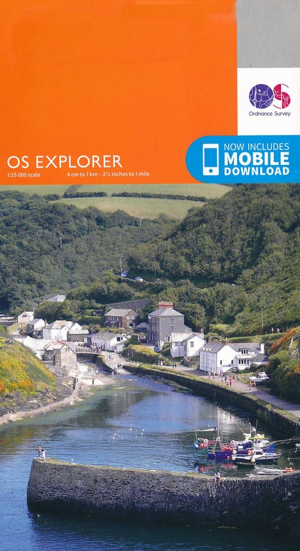
Wandelkaart 169 Cirencester & Swindon - England - OSI
Heeft betrekking op een gebied van Cirencester en Fairford
Korte omschrijving
Wandelkaart Cirencester & Swindon - England - OSI Omvat : Fairford & Cricklade. Productbeschrijving: 169 / Cirencester & Swindon, Glousctershire, England - Kaart nummer 169 in de OS ...

Specificaties
- Uitgever: Ordnance Survey
- ISBN-13: 9780319243626
- HOOFDCATEGORIEËN: Wandelkaart
- Activiteiten: Wandelen, Hiking & Trekking
- Regio: Gloucestershire, Egland
- Land: England
- Schaal: 1:25000
- Afmeting: 13x23
- Taal: Engels
- Reeks: Explorer Series OSI
Volledige omschrijving
Wandelkaart Cirencester & Swindon - England - OSI
Omvat : Fairford & Cricklade.
Productbeschrijving:
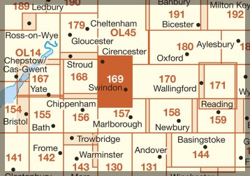
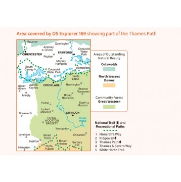
169 / Cirencester & Swindon, Glousctershire, England - Kaart nummer 169 in de OS Explorer reeks heeft betrekking op een gebied van Cirencester en Fairford met een gedeelte van de Cotswolds AONB in het noorden, tot de North Wessex Downs AONB in het zuiden. Nationale routes van Thames pad en Ridgeway vallen onder deze kaart, samen met het gebied rond Swindown van de Great Western Community Forest. Andere hoogtepunten van het gebied zijn Cricklade, Wootton Bassett en Cotswold Water Park. De OS Explorer kaart voor Cirencester & Swindon is beschikbaar in zowel de standaard papieren als de versie en weerbestendige 'Actief' versie.
169 / Cirencester & Swindon, Glousctershire, England - Map sheet number 169 in the OS Explorer series covers an area from Cirencester and Fairford with a section of the Cotswolds in the north, to the North Wessex Downs in the south. National trails of Thames Path and Ridgeway are covered by this map, along with the area around Swindown of the Great Western Community Forest. Other highlights of the area include Cricklade, Wootton Bassett and Cotswold Water Park. The OS Explorer map for Cirencester & Swindon is available in both the standard paper version and weatherproof 'Active' version.
Locatie op kaart
Gekoppelde artikelen

Wandelkaart 169 Cirencester & Swindon - England - OSI • 9780319243626
standaard versieWandelkaart Cirencester & Swindon - England - OSI Omvat : Fairford & Cricklade. Productbeschrijving: 169 / Cirencester & Swindon, Glousctershire, England - Kaart nummer 169 in de OS Explorer reeks heeft betrekking op een gebied van Cirencester en Fairford met een gedeelte van de Cotswolds AONB in het noorden, tot de North Wessex Downs AONB in het zuiden. Nationale routes van Thames…

Wandelkaart 169 Cirencester & Swindon England - OSI • 9780319470411
weatherproof versieWandelkaart Cirencester & Swindon- Gloucestershire Omvat ook: Fairford & Cricklade. Productbeschrijving: Kaart nummer 169 in de OS Explorer kaarten reeks heeft betrekking op een gebied van Cirencester en Fairford met een gedeelte van de Cotswolds AONB in het noorden, tot de North Wessex Downs AONB in het zuiden. De nationale routes van Thames pad en Ridgeway vallen onder deze kaart, sa…
Overzichtskaarten

OSI Explorer & Explorer Active - Z.W. England Devon - Cornwall
OSI Explorer & Explorer Active - Z.W. England Devon - Cornwall

Producten op de overzichtskaart
Klik op een product om naar de detailpagina te gaan.
- Wandelkaart 102 Land's End - OSI
- Wandelkaart 102 Land's End - OSI
- Wandelkaart 103 The Lizard- Cornwall England - OSI
- Wandelkaart 103 The Lizard- Cornwall England - OSI
- Wandelkaart 104 Redruth & St Agnes- Cornwall - OSI
- Wandelkaart 104 Redruth & St Agnes- Cornwall - OSI
- Wandelkaart 105 Falmouth & Mevagissey - Cornawall - OSI
- Wandelkaart 105 Falmouth & Mevagissey - Cornawall - OSI
- Wandelkaart 106 Newquay & Padstow - Cornwall - OSI
- Wandelkaart 106 Newquay & Padstow- Cornwall - OSI
- Wandelkaart 107 St-Austell & Liskeard- Cornwall - OSI
- Wandelkaart 107 St-Austell & Liskeard & Fowey- Cornwall - OSI
- Wandelkaart 108 Lower Tamar Valley & Plymouth - OSI
- Wandelkaart 108 Lower Tamer Valley & Plymouth- Cornwall - OSI
- Wandelkaart 109 Bodmin Moor- Cornwal - OSI
- Wandelkaart 109 Bodmin Moor- Cornwal - OSI
- Wandelkaart 111 Bude- Boscastle & Tintagel- Devon - OSI
- Wandelkaart 111 Bude- Boscastle & Tintagel- Devon - OSI
- Wandelkaart 112 Launceston & Holsworthy- Devon - OSI
- Wandelkaart 112 Launceston & Holsworthy- Devon - OSI
- Wandelkaart 113 Okehampton- Devon England - OSI
- Wandelkaart 113 Okehampton- Devon England - OSI
- Wandelkaart 114 Exeter & Exe Valley- Devon - OSI
- Wandelkaart 114 Exeter & Exe Valley- Devon - OSI
- Wandelkaart 115 Exmouth & Sidmouth- Devon - OSI
- Wandelkaart 115 Exmouth & Sidmouth- Devon - OSI
- Wandelkaart 116 Lyme regis & Bridport- Devon - OSI
- Wandelkaart 116 Lyme Regis & Bridport- Dorset - OSI
- Wandelkaart 117 Cerne Abbas & Bere Regis - Dorset - OSI
- Wandelkaart 117 Cerne Abbas & Bere Regis - Dorset - OSI
- Wandelkaart OL15 Purbeck- South Dorset & Poole - OSI
- Wandelkaart 118 Shaftesbury & Cranbourne Chase - OSI
- Wandelkaart 118 Shaftesbury & Cranbourne Chase - OSI
- Wandelkaart 129 Yeovil & Sherborne- Somerset - OSI
- Wandelkaart 129 Yeovil & Sherborne- Somerset - OSI
- Wandelkaart 140 Quantock Hills AONB & Bridgwater- Devon - OSI
- Wandelkaart 140 Quantock Hills AONB- Somerset - OSI
- Wandelkaart 141 Cheddar Gorge & Mendip Hills - OSI
- Wandelkaart 141Shepton Mallet & Mendip Hills East - OSI
- Wandelkaart 142 Shepton Mallet & Mendip Hills - OSI
- Wandelkaart 142 Shepton Mallet & Mendip Hills - OSI
- Wandelkaart 143 Warminster & Trowbridge- Wiltshire - OSI
- Wandelkaart 143 Warminster & Trowbridge- Wiltshire - OSI
- Wandelkaart 130 Salisburry & Stonehenge- Wiltshire - OSI
- Wandelkaart 130 Salisburry & Stonehenge- Wiltshire - OSI
- Wandelkaart 131 Romsey- Andover & Test Valley- Hampshire
- Wandelkaart 131 Romsey & Andover - Hampshire - OSI
- Wandelkaart 153 Weston-super-Mare & Bleadon Hill - OSI
- Wandelkaart 153 Weston-Super-Mare & Bleadon Hill - OSI
- Wandelkaart 154 Bristol West & Portishead- Bristol - OSI
- Wandelkaart 154 Bristol West & Portishead- Bristol area
- Wandelkaart 155 Bristol & Bath Keynsham & Marshfield - OSI
- Wandelkaart 155 Bristol & Bath- Bristol Area - OSI
- Wandelkaart 156 Chippenham & Bradford-on-Avon - OSI
- Wandelkaart 156 Chippenham & Bradford-on-Avon- Wiltshire - OSI
- Wandelkaart 157 Marlborough & Savernake Forest - OSI
- Wandelkaart 157 Marlborough & Savernake Forest - OSI
- Wandelkaart 158 Newbury & Hungerford- Berkshire - OSI
- Wandelkaart 158 Newbury & Hungerford- West Berkshire - OSI
- Wandelkaart 167 Thornbury- Dursley & Yate - England- OSI
- Wandelkaart 167 Thornbury- Dursley & Yate - England- OSI
- Wandelkaart 168 Stroud- Tetbury & Malmesbury - OSI
- Wandelkaart 168 Stroud- Tetbury & Malmesbury - OSI
- Wandelkaart 169 Cirencester & Swindon - England - OSI
- Wandelkaart 169 Cirencester & Swindon - England - OSI
- Wandelkaart 170 Abingdon & Wantage - Oxfordshire - OSI
- Wandelkaart 170 Abingdon- Wantage & Vale - OSI
- Wandelkaart 179 Gloucester- Cheltenham & Stroud - OSI
- Wandelkaart 179 Gloucester- Cheltenham & Stroud - OSI
- Wandelkaart OL45 The Cotswolds AONB- Gloucestershire - OSI
- Wandelkaart 190 Malvern Hills AONB & Bredon Hill - OSI
- Wandelkaart 190 Malvern Hills AONB & Bredon Hill - OSI
- Wandelkaart 205 Stratford-upon-Avon & Evesham - OSI
- Wandelkaart 205 Stratford-upon-Avon & Evesham - OSI
- Wandelkaart 206 Edge Hill & Fenny Compton - OSI
- Wandelkaart 206 Edge Hill & Fenny Compton - OSI

OSI Explorer & Explorer Active - Zuid England
OSI Explorer & Explorer Active - Zuid England

Producten op de overzichtskaart
Klik op een product om naar de detailpagina te gaan.
- Wandelkaart 117 Cerne Abbas & Bere Regis - Dorset - OSI
- Wandelkaart 118 Shaftesbury & Cranbourne Chase - OSI
- Wandelkaart 129 Yeovil & Sherborne - Somerset - OSI
- Wandelkaart 130 Salisburry & Stonehenge- Wiltshire - OSI
- Wandelkaart 131 Romsey & Andover - Hampshire - OSI
- Wandelkaart 135 Ashdown Forest - East Sussex - OSI
- Wandelkaart 141 Cheddar Gorge & Mendip Hills - OSI
- Wandelkaart 142 Shepton Mallet & Mendip Hills - OSI
- Wandelkaart 143 Warminster & Trowbridge - Wiltshire - OSI
- Wandelkaart 144 Basingstoke - Alton & Whitchurch - OSI
- Wandelkaart 145 Guildford & Farnham- Surrey - OSI
- Wandelkaart 146 Dorking- Box Hill & Reigate- Surrey - OSI
- Wandelkaart 147 Sevenoaks & Tonbridge- Kent - OSI
- Wandelkaart 154 Bristol West & Portishead- Bristol - OSI
- Wandelkaart 155 Bristol & Bath & Bristol Area - OSI
- Wandelkaart 156 Chippenham & Bradford-on-Avon - OSI
- Wandelkaart 157 Marlborough & Savernake Forest - OSI
- Wandelkaart 158 Newbury & Hungerford- Berkshire - OSI
- Wandelkaart 159 Reading- S.E. England - OSI
- Wandelkaart 160 Windsor- Weybridge & Bracknell - OSI
- Wandelkaart 161 London South - OSI
- Wandelkaart 162 Greenwich & Gravesend - OSI
- Wandelkaart 167 Thornbury- Dursley & Yate - England- OSI
- Wandelkaart 168 Stroud- Tetbury & Malmesbury - OSI
- Wandelkaart 169 Cirencester & Swindon - England - OSI
- Wandelkaart 170 Abingdon & Wantage - Oxfordshire - OSI
- Wandelkaart 171 Chiltern Hills West AONB - Wycombe - OSI
- Wandelkaart 172 Chiltern Hills East AONB - Wycombe - OSI
- Wandelkaart 173 London North- England - OSI
- Wandelkaart 174 Epping Forest & Lee Valley- Essex - OSI
- Wandelkaart 179 Gloucester- Cheltenham & Stroud - OSI
- Wandelkaart 180 Oxford- England - OSI
- Wandelkaart 181 Chiltern Hills North AONB- Wycombe - OSI
- Wandelkaart 182 St-Albans & Hatfield- Hertfordshire - OSI
- Wandelkaart OL22 New Forest- Southampton & Ringwood - OSI
- Wandelkaart OL32 Winchester & New Alresford - OSI
- Wandelkaart OL33 Haslemere- Petersfield & Midhurst - OSI
- Wandelkaart OL34 Crawley- Horsham & Cranleigh - OSI
- Wandelkaart OL29 Isle of Wight & Cowes - OSI
- Wandelkaart OL3 Meon Valley- Portsmouth & Gosport - OSI
- Wandelkaart OL3 Meon Valley- Portsmouth & Gosport - OSI
- Wandelkaart OL11 Brighton & Hove - Ordnance Survey
- Wandelkaart OL25 Eastbourne & Beachy Head - OSI
- Wandelkaart OL8 Chichester South Harting- England - OSI
Artikelen uit dezelfde regio

Wandelgids Walking in the Forest of Dean - Cicerone • 9781852846893
Wandelgids - Walking in the Forest of Dean - Cicerone Productomschrijving: Een gids over 25 wandelingen in de Forest of Dean, met alle informatie die nodig is om te genieten van een scala aan wandelingen in de dallen en de open ruimtes van dit oude gebied. Van korte 4-mijl lange wandelingen tot volle dagsecties van interlokale paden zoals de Offa's Dyke Path en Gloucestershire Way, is deze…

Fotoboek Cotswold - The landscape of Britain - Goldeneye • 9781859652312
Fotoboek Cotswold Collection - The landscape of Britain Productomschrijving: Dit prachtig geproduceerde boek van fotografie vangt de essentie van de Cotswolds op, van de huiselijke dorpen, de kerken en de landhuizen, naar de betoverende wildernis van de zachte riviervalleien en glooiende heuvels - een vertrouwd landschap gevangen op een unieke en opvallende manier. De foto's werden sa…

Wandelkaart 168 Stroud- Tetbury & Malmesbury - OSI • 9780319470404
Wandelkaart Stroud- Tetbury & Malmesbury - England Productbeschrijving: Kaart nummer 168 in de OS Explorer kaarten reeks omvat Stroud, Tetbury, Malmesbury en Nailsworth. Hoogtepunten van het gebied zijn onder meer: Cotswolds AONB, Cotswold Way, Monarch Way en de Thames Path. De OS Explorer kaart voor Stroud, Tetbury & Malmesbury is beschikbaar in zowel de standaard papieren versie als de w…
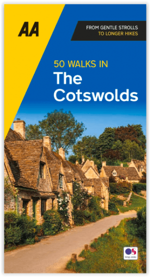
Wandelgids Cotswolds AONB 50 walks guide - AA Publishing • 9780749583224
Cotswolds AONB - 50 walks guide - AA Publishing Productomschrijving: Wandelen is een van de favoriete vrijetijdsbestedingen van Groot-Brittannië. AA 50 Walks in the Cotswolds bevat een verscheidenheid aan uitgestippelde wandelingen van 3 tot 12 km, geschikt voor alle niveaus. Het boek bevat alle praktische details die u nodig hebt, vergezeld van boeiende achtergrondinformatie over de gesch…

Wandelgids Exploring the Cotswolds - Goldeneye • 9781859652862
Exploring the Cotswolds - Goldeneye Productomschrijving: Dit Cotswold Boek is anders. Het is een onafhankelijke stem, omdat alle inzendingen worden gekozen op basis van verdienste, en verdienste alleen. In ons digitale tijdperk waar (reis) informatie wordt verstrekt door enorme reclame budgetten. Hierbij een verfrissende en verhelderende kijk op wat de Cotswolds de bezoeker en bewoner te b…