
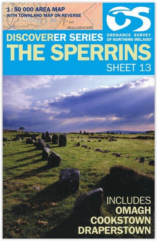
Wandelkaart 13 The Sperrins Ulster N. Ireland - OSNI
De Sperrins of genaamd de Sperrin Mointains
Korte omschrijving
The Sperrins Ulster Northern Ireland - OSI Productomschrijving: De Sperrins of genaamd de Sperrin Mointains, zijn een gebergte in N.W. Noord-Ierland, meer bepaald in de districten Mid Ulster...

Specificaties
- Uitgever: Ordnance Survey
- ISBN-13: 9781905306848
- HOOFDCATEGORIEËN: Wandelkaart
- Activiteiten: Wandelen, Hiking & Trekking
- Regio: Northern Ireland, UK, Ulster, Ireland
- Land: Noord Ierland
- Schaal: 1:50000
- Afmeting: 11x18
- Taal: Engels
Volledige omschrijving
The Sperrins Ulster Northern Ireland - OSI
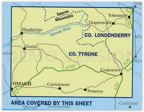
Productomschrijving: De Sperrins of genaamd de Sperrin Mointains, zijn een gebergte in N.W. Noord-Ierland, meer bepaald in de districten Mid Ulster, Fermanagh and Omagh en Derry and Strabane.
Key Features:
- Each map covers an area of 40km x 30km and is based on the Irish Grid co-ordinate system
- The OSNI Discoverer Series is fully compatible with the Republic of Ireland Discovery Series, using the same sheet numbering system, same co-ordinate system, same data source in the border areas and a similar cartographic style
- The OSNI Discoverer Series contains important tourist information including youth hostels, picnic areas, view points, camp sites and shows road classification, way marked walks, paths and numbered national cycle networks
- Some maps include a townland map on the reverse, with an index for easy reference
- Shows water features such as loughs, rivers and canals with names, as well as beaches and marshes
- Easy to use legend printed in English, French and German
- Relief is shown in easy to read coloured layers and includes contours at 10m intervals
Technical Information:
- There are 18 sheets in the series. The sheet numbering system is on an all Ireland basis
- Scale of 1:50 000 i.e. 2cms on the map represents 1km on the ground
- Updated every three years
- Full Irish Grid co-ordinates enabling a unique reference to be given to any feature or point
- Digitally derived from OSNI’s large-scale database
- All International, County and Local Government District boundaries shown.
Locatie op kaart
Overzichtskaarten

OSI Northern Ireland - OSNI
OSI Northern Ireland - OSNI

Producten op de overzichtskaart
Klik op een product om naar de detailpagina te gaan.
- Wandelkaart 04 Discoverer Coleraine- Northern Ireland - OSNI
- Wandelkaart 05 Discoverer Ballycastle - Discoverer series - OSNI
- Wandelkaart 07 Discoverer Londonderry- Ulster - N.Ireland - OSNI
- Wandelkaart 08 Ballymoney County Antrim - OSNI
- Wandelkaart 09 Larne County Antrim - OSNI
- Wandelkaart 13 The Sperrins Ulster N. Ireland - OSNI
- Wandelkaart 14 Discoverer Lough Neagh - Antrim - N.Ireland - OSNI
- Wandelkaart 15 Discoverer Belfast - OSNI
- Wandelkaart 17 Discoverer Lower Lough Erne - OSNI
- Wandelkaart 18 Discoverer Enniskillen & Irvinestown - OSNI
- Wandelkaart 19 Discoverer Armagh - OSNI
- Wandelkaart 20 Discoverer Craigavon- N.Ireland - OSNI
- Wandelkaart 21 Discoverer Strangford Lough - OSNI
- Wandelkaart 27 Upper Lough Erne (Lisnaskea) - OSNI
- Wandelkaart 28 Monaghan-Keady (Castleblayney) - OSNI
- Wandelkaart 29 Discoverer The Mournes - OSNI
Artikelen uit dezelfde regio

Wandelkaart 05 Discoverer Ballycastle - OSNI • 9781911643005
Wandelkaart Ballycastle N. Ireland - OSI Productomschrijving: Ballycastle is een locatie in het Noord-Ierse graafschap County Antrim. Omvat: Ballymoney, Bushmills, Cushendall & Rathlin Island.

Reisgids Great Britain - Lonely Planet • 9781838693541
Reisgids Great Britain - Lonely Planet Productomschrijving: Buckingham Palace, Stonehenge, Manchester United, The Beatles - Groot-Brittannië heeft iconen zoals nergens anders en reizen hierheen is een fascinerende mix van beroemde namen en verborgen juweeltjes.. Omvat: London, Canterbury, Southeast England, Oxford, Cotswolds, Southwest England, Cambridge, East Anglia, Birmingham, the M…

Wandelkaart XT25 Mourne Mountains N. Ireland - Harvey maps • 9781851376124
Wandelkaart - Mourne Mountains N. Ireland - Harvey maps Productomschrijving: Noord Ireland behoort toe aan Engeland, maar geen enkel haar op het hoofd doet denken aan Engeland als u in Noord Ierland rond loopt in de Morne Mountains, of de mournes ook soms wel genaamd. U kunt het zo wat vergelijken met de Schotse Highlands. Eveneens geen regio die doet denken aan Engeland. De Mourne Mountai…

Reisgids Great Britain - DK Eyewitness • 9780241408292
Reisgids Great Britain - DK Eyewitness Productomschrijving: Visit Stonehenge's mysterious monoliths, take the sea air in buzzing Brighton or come face to face with the Vikings in York: everything you need to know is clearly laid out within colour-coded chapters. Discover the best of Great Britain with this indispensable travel guide. Inside DK Eyewitness Travel Guide Great Britain: -…

Wandelgids The Mourne mountains - Knife Edge • 9781912933037
Wandelgids - The Mourne mountains - Knife Edge Outdoor Limited Productomschirjving: De enige gids die gaat over de Mourne Mountains in Noord Ierland, geschreven door een lokale wandelaar van County Down: 30 uitgekozen routes met Real 1: 25.000 kaarten: dit maakt navigatie eenvoudig en bespaart u geld: geen extra kaarten nodig. Engelse omschrijving: The only guidebook for the Mourne Mou…