
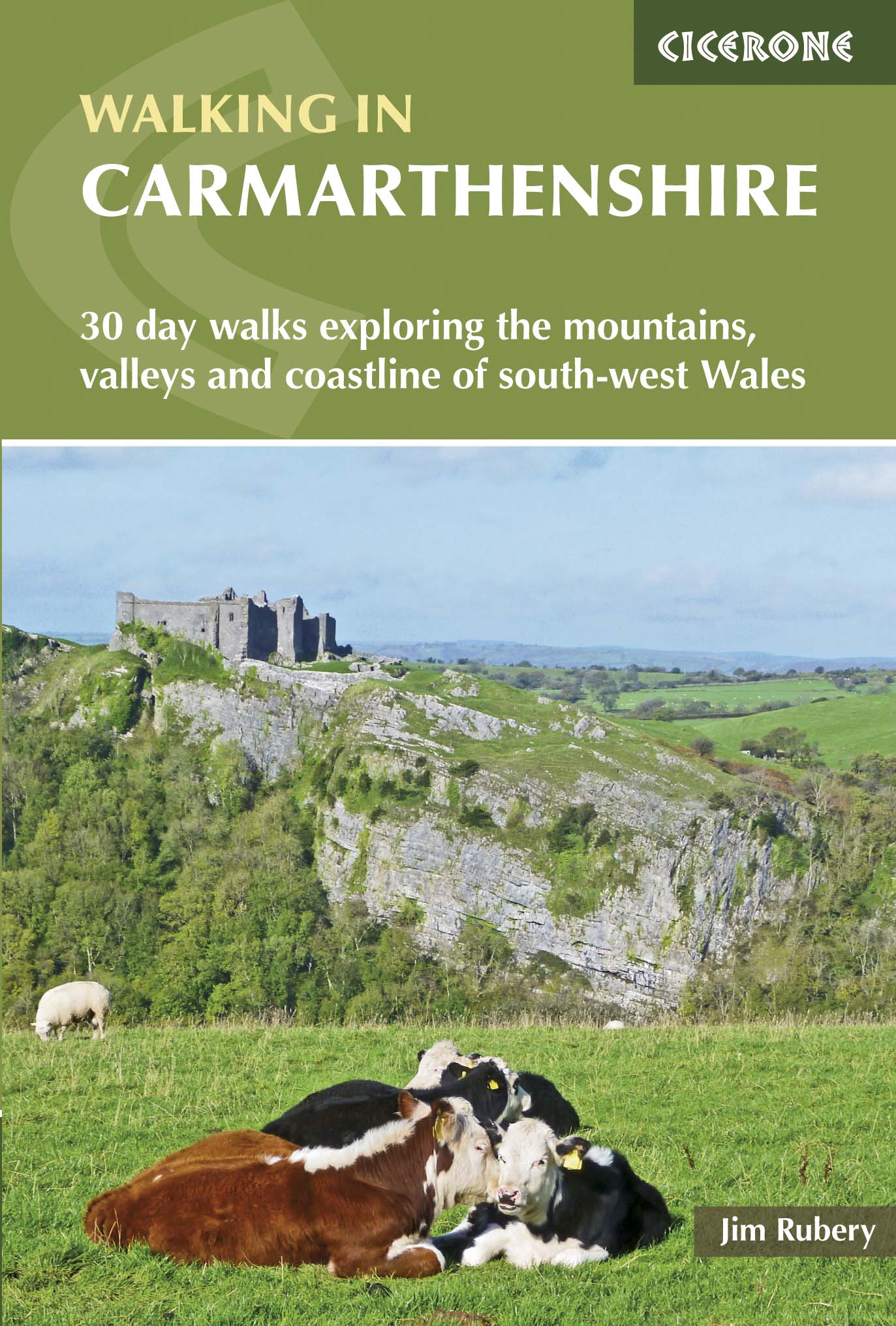
Wandelgids Walking in Carmarthenshire South Wales - Cicerone
Zuid-Wales- met delen van het Carmarthenshire Coast Path
Korte omschrijving
Wandelgids - Walking in Carmarthenshire South Wales - Cicerone Productomschrijving: Deze gids beschrijft 30 wandelroutes van (2 to 10 mijl) in Carmarthenshire, Zuid-Wales, met inbegrip van d...

Specificaties
- Uitgever: CICERONE Press
- ISBN-13: 9781852847371
- HOOFDCATEGORIEËN: Wandelgids
- Activiteiten: Wandelen, Hiking & Trekking
- Auteur: Jim Rubery
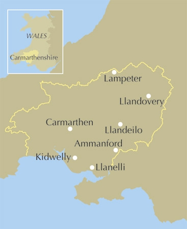
- Regio: South Wales
- Land: Wales
- Blz.: 176
- Afmeting: 12x17
- Editie: 1
- Taal: Engels
Volledige omschrijving
Wandelgids - Walking in Carmarthenshire South Wales - Cicerone
Productomschrijving: Deze gids beschrijft 30 wandelroutes van (2 to 10 mijl) in Carmarthenshire, Zuid-Wales, met inbegrip van delen van het "Carmarthenshire Coast Path". Wandelingen voor alle niveaus, met inbegrip van de kust, rivier, bos- en heuvelwandelingen in de Cambrian Mountains, Tywi Valley, Y Mynydd Du (Zwarte Bergen) en de Brecon Beacons. Gemakkelijke toegang tot deze gebieden vanaf Bristol, Cardiff en Swansea.
Product description: Guidebook to 30 walking routes (2 to 10 miles) in Carmarthenshire, south Wales, including sections of Carmarthenshire Coast Path. Walks for all abilities, including coastal, river, forest and hill walks in Cambrian Mountains, Tywi Valley, Y Mynydd Du (Black Mountains) and Brecon Beacons. Easy access from Bristol, Cardiff and Swansea.
Seasons:
The walks can be done at any time of year, but the drier months from April to October would suit the higher mountain walks.
Centres:
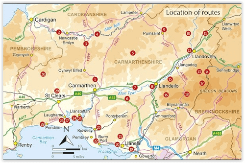
Most of the walks can be reached, either by car or public transport, from Carmarthen, Llandeilo, Llanelli and Llandovery.
Difficulty:
The walks are organised by level of difficulty, based on length, amount of ascent and the type of terrain they cover. Some are quite short with little effort required, others require considerably more time and can be quite challenging, as they head out into open country where knowledge of map and compass use is highly recommended.
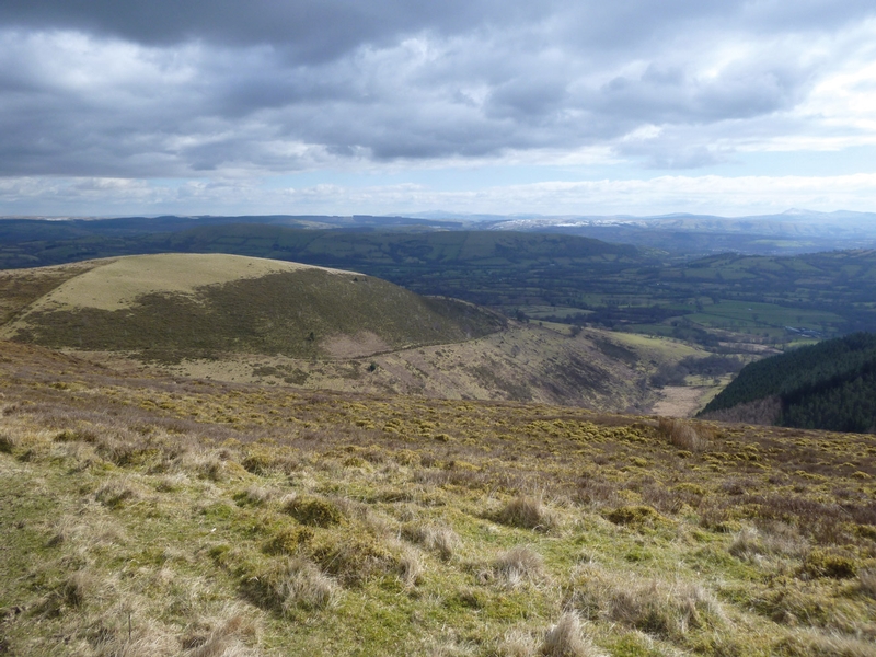
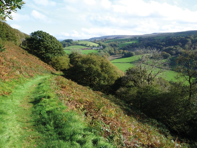
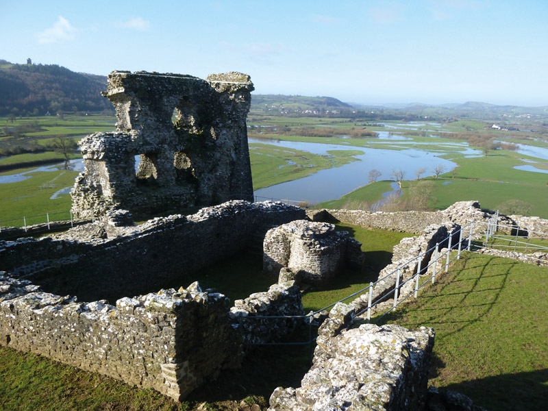
Must See:
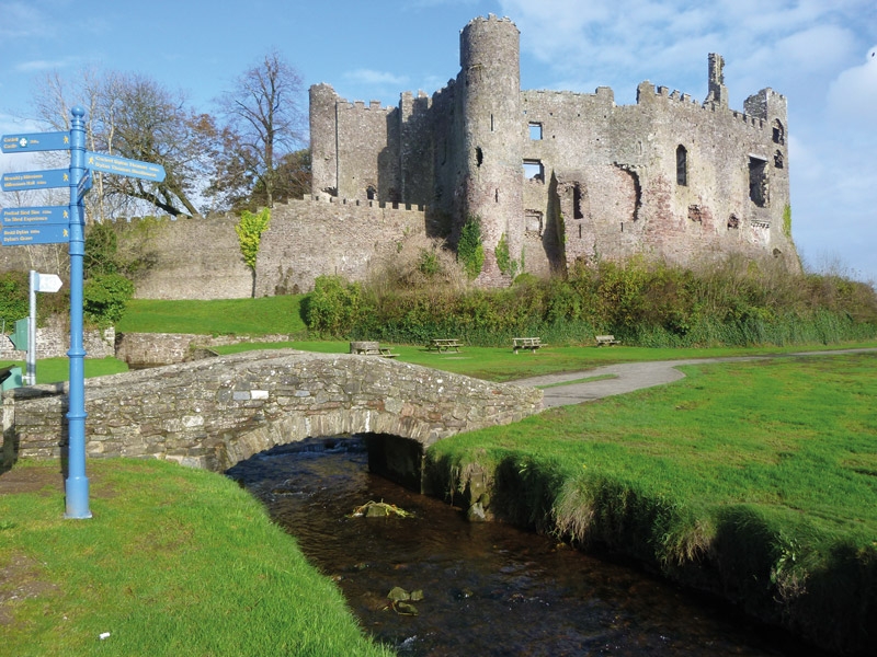
With mile upon mile of golden sands, breathtaking mountain scenery, fast-flowing rivers, quiet upland lakes, attractive market towns, extensive tracts of forest, evocative castle ruins, empty country lanes and a rich industrial heritage, it is not surprising that Carmarthenshire is fast becoming a walking hotspot.
Locatie op kaart
Artikelen uit dezelfde regio
Wandelgids Brecon Beacons - A walker's guide - Cicerone • 9781852845544
Wandelgids Brecon Beacons - a walker's guide - Cicerone Productomschrijving: Een handige wandelgids die 45 circulaire dagroutes beschrijft in het Brecon Beacons National Park. Van west naar oost, Mynydd Du, Fforest Fawr, de Brecon Beacons en de Black Mountains bieden een breed scala van opties voor wandelaars. De beschreven wandelingen vermijden de minder interessante, meer populaire route…

Wandelkaart 178 Llanelli & Ammanford - OSI • 9780319470503
Wandelkaart Llanelli & Ammanford & Rhydaman - OSI Omvat ook: Kidwelly. Productbeschrijving: Kaart nummer 178 dekt Llanelli, Ammanford en Kidwelly. Hoogtepunten zijn Brecon Beacons National Park. Omvat ook Lliedi Resr, Gorseinon, Burry Port, Llanddarog en Llangain. De OS Explorer kaart voor Llanelli & Ammanford is beschikbaar in zowel de standaard papieren versie als de weerbestendige '…

Wandelkaart 152 Newport & pontypool South Wales - OSI • 9780319470244
Wandelkaart Newport & pontypool - South Wales Productbeschrijving: OS Explorer kaart 152 toont Pontypool aan Newport en de monding van de Severn. Dit gebied is zeer belangrijk voor wilde dieren, met veel van het estuarium die als een site van bijzonder wetenschappelijk belang word aangewezen. De OS Explorer kaart voor Newport & Pontypool is beschikbaar in zowel de standaard papieren versie…

Wandelkaart 151 Cardiff & Bridgend - South Wales - OSI • 9780319470237
Wandelkaart Cardiff & Bridgend / Caerdydd a Phen-y-bont - Wales Omvat ook: Vale of Glamorgan. Productbeschrijving: Kaart nummer 151 in de OS Explorer kaarten reeks heeft betrekking op Cardiff en Bridgend in Zuid-Wales. Dit populaire gebied van Wales omvat steden waaronder Porthcawl, Cowbridge en Barry, met inbegrip van wandelingen door de Valeways Millenium heritage Trail, Bridgend cir…
Wandelkaart XT40 Brecon Beacons Oost Wales - Harvey Maps • 9781851376001
Wandelkaart -XT40 Brecon Beacons Oost Wales - Harvey Maps Productomschrijving: Omvat een grote oppervlakte, maar is heel handig & compact. Gedetailleerde kaart voor hardlopers en wandelaars van het oostelijke deel van het Brecon Beacons National Park en de Black Mountains op de magische schaal van 1:40, 000. Omvat: Pen y Fan en de Black Mountains. Welsh-Engelse tekst.