
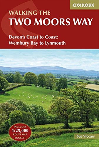
Wandelgids The Two Moors Way - Cicerone
Two Moors Way beslaat 153 km van Ivybridge naar Lynmouth
Korte omschrijving
Wandelgids, The Two Moors Way (9781852849917) Cicerone Press Productomschrijving: De oorspronkelijke Two Moors Way beslaat 153 km van Ivybridge aan de zuidelijke grens van Dartmoor National ...

Specificaties
- Uitgever: CICERONE Press
- ISBN-13: 9781852849917
- HOOFDCATEGORIEËN: Wandelgids
- Activiteiten: Wandelen, Hiking & Trekking
- Auteur: Sue Viccars
- Regio: Devon, England
- Land: England
- Lange afstand wandelroutes: The Two Moors Way, England (153 km)
- Nationale parken: Dartmoor NP, Devon England, Exmoor NP, Devon England
- Blz.: 216
- Afmeting: 12x17
- Editie: 2
- Taal: Engels
Volledige omschrijving
Wandelgids, The Two Moors Way (9781852849917) Cicerone Press
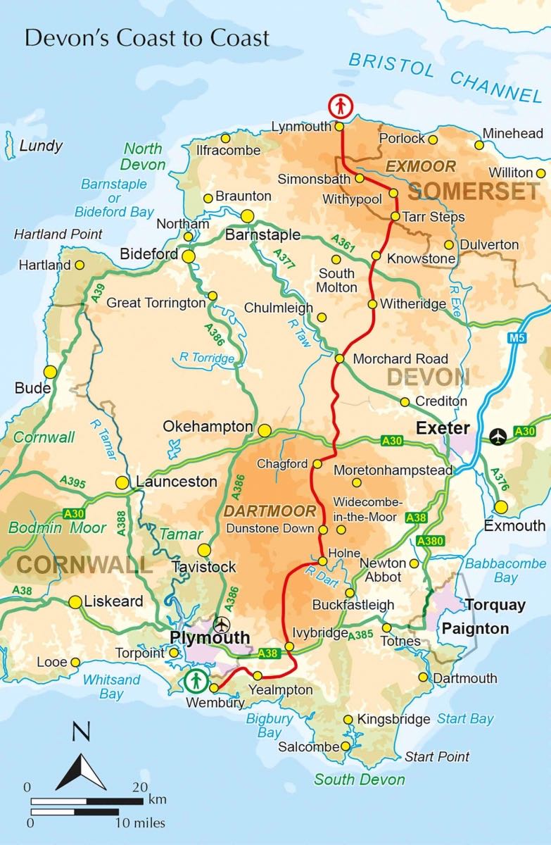
Productomschrijving: De oorspronkelijke Two Moors Way beslaat 153 km van Ivybridge aan de zuidelijke grens van Dartmoor National Park naar Lynmouth aan de kust van Noord-Devon in Exmoor National Park. Als u een Coast to Coast-wandeling wilt maken, kunt u beginnen bij Wembury aan de kust van Zuid-Devon en de Erme-Plym-route volgen naar Ivybridge, waarbij u ongeveer 15 mijl toevoegt.
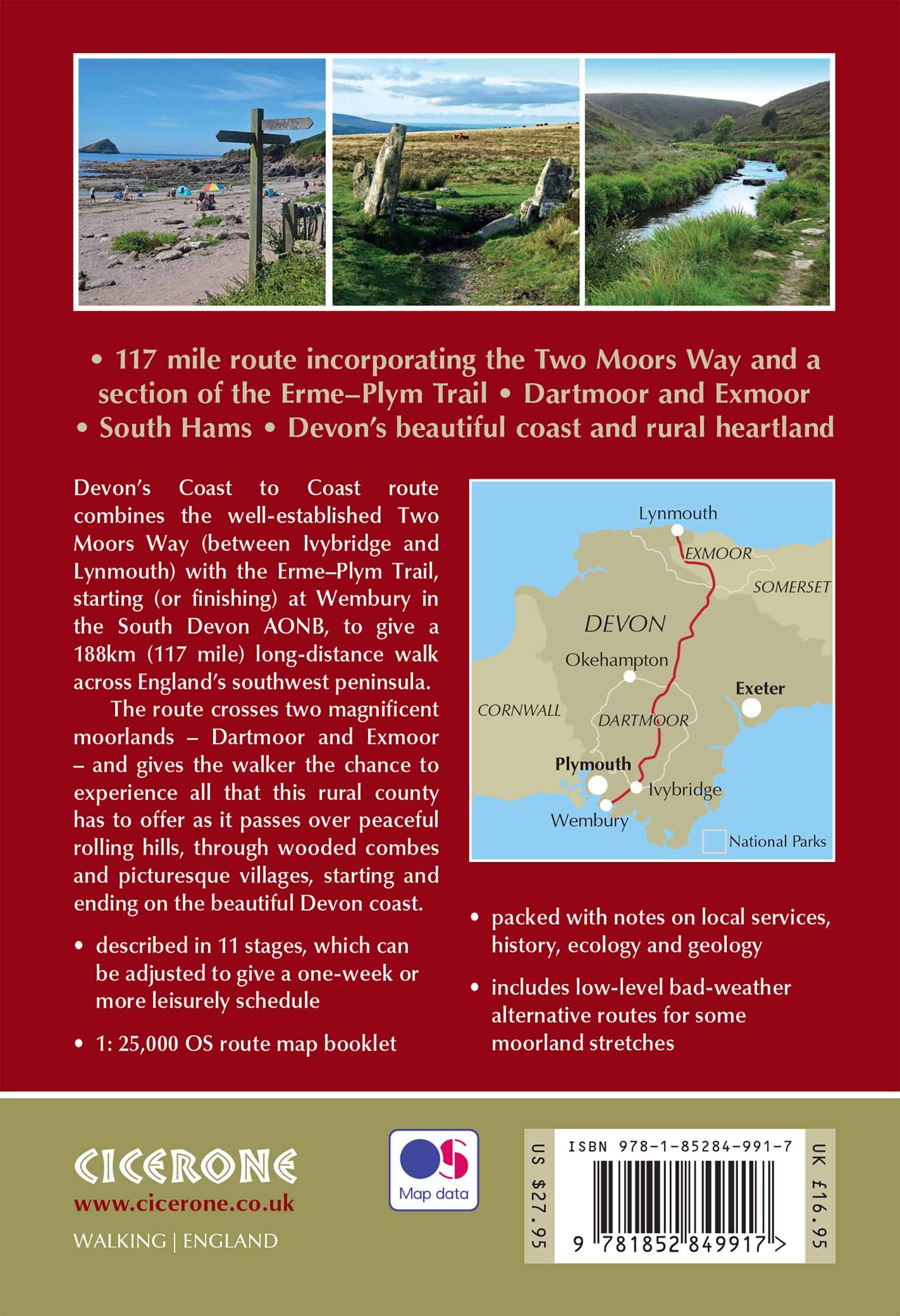
Product description: This guidebook to walking Coast to Coast across Devon, presents a 117 mile route incorporating the Two Moors Way and a section of the Erme-Plym Trail. Beginning at Wembury Bay on the south coast and finishing at Lynmouth, the 11-stage walk passes through the beautiful Devon countryside and across two of southwest England’s magnificent moorlands, Dartmoor and Exmoor. The schedule can be adjusted to give a one-week walk, or a more leisurely pace if preferred, and the book includes low-level bad-weather alternative routes for some moorland stretches.
A full route description is given for walking the route from south to north, with a summary description for walking in the opposite direction. 1:50,000 map extracts show the route and there is lots of practical information on public transport, refreshments and accommodation to make day-by-day planning simple. A map booklet showing the full route on OS 1:25K maps is included with this guide. The county of Devon incorporates a wonderful range of landscapes, from the rolling fields of South Devon and the narrow-hedged lanes of Mid Devon to the wild, wide-open spaces of Dartmoor, home to hill ponies, granite tors and Bronze Age relics. To the north, Exmoor’s sandstone moorland sweeps down to the sea, and lofty coastal hills tower over the Bristol Channel
Locatie op kaart
Artikelen uit dezelfde regio

Wandelgids SWCP part 3 - Dorset & South Devon - Trailblazer • 9781912716340
Wandelgids SWCP part 3 - Dorset & South Devon - Trailblazer Productomschrijving: Dorset & South Devon Coast Path (South-West Coast Path Part 3) This guide covers the third and last section of the South West Coast Path, from Plymouth to Poole Harbour (217 miles). This beautiful route includes 95 miles within England’s only Natural World Heritage Site, the Jurassic Coast, and passes dram…

Wandelkaart 115 Exmouth & Sidmouth- Devon - OSI • 9780319469958
Wandelkaart Exmouth & Sidmouth - Devon England - OSI Productbeschrijving: Kaart nummer 115 in de OS Explorer reeks heeft betrekking op de east Devon kust met inbegrip van Exmouth, Sidmouth, Honiton, Budleigh Salterton en Ottery St Mary. Highlights van het gebied omvatten: Blackdown Hills, Oost-Devon AONB, East Devon Way en de South West Coast Path. De OS Explorer kaart voor Exmouth & Sidmo…

Wandelkaart 191 Okehampton & North Dartmoor NP - OSI • 9780319262894
Wandelkaart Okehampton & North Dartmoor NP - England Productbeschrijving: Kaart nummer 191 in de OS Landranger kaarten reeks, is de perfecte kaart om te gebruiken bij het plannen van een reis naar het Okehampton gebied van Devon. Het gebied heeft veel te bieden voor vakantiegangers en dagjesmensen die uitstekend wandel- en landschappen willen beleven. Hoogtepunten van het gebied zijn onde…

Wandelkaart 180 Barnstable & Ilfracombe Devon England - OSI • 9780319262788
Wandelkaart Barnstable & Ilfracombe - Devon England Productbeschrijving: Kaart nummer 180 is een all purpose kaart vol gepakt met informatie om u het gebied te helpen leren kennen. De 204 Landranger-kaarten bestrijken het land. Elke kaart heeft een oppervlakte van 40 km door 40 km (25 mijl door 25 mijl) en zoals andere kaarten van Ordnance Survey, National Grid-vierkanten worden verstrekt …

Reisgids Devon & Cornwall - Top 10 - DK Eyewitness • 9780241408568
Devon & Cornwall - DK Eyewitness Productomschrijving: Bewonder de historische kathedraal van Exeter, doorkruis te voet de uitgestrekte wildernis van Dartmoor, geniet van prachtige stranden op de Isles of Scilly, ontdek een bloeiende kunstscene in St-Ives of bewonder de spectaculaire reusachtige kassen van het Eden Project. Van de Top 10 stranden tot de Top 10 treinreizen - ontdek het beste…