
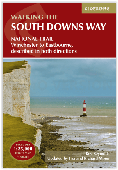
Wandelgids The South Downs Way - Cicerone
Tussen Winchester en Eastbourne - 160 km - 12 etappes
Korte omschrijving
The South Downs Way - Cicerone Productomschrijving: Wandelgids over de South Downs Way National Trail, een route van 100 mijl (160 km) tussen Winchester en Eastbourne door het South Downs Na...

Specificaties
- Uitgever: CICERONE Press
- ISBN-13: 9781786311610
- HOOFDCATEGORIEËN: Wandelgids
- Activiteiten: Wandelen, Hiking & Trekking
- Auteur: Ilsa Moon, Kevin Renolds, Richard Moon
- Regio: South England, Sussex, England
- Land: England
- Lange afstand wandelroutes: South Down's Way, (160 km)
- Nationale parken: South Downs NP, Sussex Egland
- Blz.: 200
- Schaal: 1:25000
- Afmeting: 12x17
- Editie: 5
- Taal: Engels
Volledige omschrijving
The South Downs Way - Cicerone
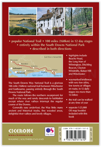
Productomschrijving: Wandelgids over de South Downs Way National Trail, een route van 100 mijl (160 km) tussen Winchester en Eastbourne door het South Downs National Park, beschreven in beide richtingen over 12 etappes. Gemakkelijke wandelingen over oude en historische paden, langs beboste gebieden, prachtige rivierdalen en mooie dorpjes. Met 1:25K OS kaartenboekje.
Engelse omschrijving: Guidebook to walking the South Downs Way National Trail, a 100 mile (160km) route between Winchester and Eastbourne through the South Downs National Park, described in both directions over 12 stages. Easy walking on ancient and historical tracks, taking in wooded areas, delightful river valleys and pretty villages. With 1:25K OS map booklet.
Seasons:
Can be walked at all times of year - this is one of the driest and warmest parts of England.
Centres:
Eastbourne, Alfriston, Lewes, Amberley, Burint, Exton, Winchester.
Difficulty:
The South Downs Way is a waymarked bridleway; very few stiles, few towns/villages en route: 12 stages (max length 12 miles).
Must See Must SeeBeachy Head, Long Man of Wilmington, Ditchling Beacon, Clayton Windmills, Butser Hill, Winchester.
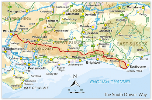
Locatie op kaart
Artikelen uit dezelfde regio

Reisgids Kent- Sussex & Surrey - Rough Guides • 9781789195804
Reisgids Kent- Sussex & Surrey - Rough Guides Productomschrijving: The brand-new, full-colour Rough Guide to Kent, Sussex & Surrey is the ultimate guide to this beautiful corner of England, with clear maps and lively accounts of both the big cultural attractions and the smaller, quirkier sights, and full coverage of vibrant Brighton and historic Canterbury. The region is fast gaining a…

Wandelgids South Downs NP short walks - Cicerone • 9781786312037
South Downs NP short walks - Cicerone Productomschrijving: 15 van de beste en mooiste wandelingen in het gebied van de Nationaal park van de South Downs, in de omgeving van Brighton, Eastbourne & Arundel. De gids komt met topografische kaarten erin van de befaamde cartograaf van Ordnance Survey. Perfect voor mensen die de South Downs nog nooit hebben bewandeld, en die opzoek zijn naar iets…

Wandelkaart 186 Aldershot & Guildford England - OSI • 9780319262849
Wandelkaart Aldershot & Guildford - Hampshire England Productbeschrijving: Kaart nummer 186 in de OS Landranger kaarten reeks, is perfect voor het plannen van een vakantie in het gebied Aldershot en Guildford. Deze plaats heeft vele bezienswaardigheden en bezeigheden, zoals de fantastische winkels in Guildford, of wandelen in de Noord-Downs. Hoogtepunten van het gebied: The North Downs Way…

Reisgids England's South Coast - DK Eyewitness • 9780241290316
Reisgids England's South Coast - DK Eyewitness Productomschrijving: Experience the dark and brooding landscape of Dartmoor, laze on golden sandy beaches on the Jurassic coast or enjoy a day out at the seaside in Brighton: everything you need to know is clearly laid out within colour-coded chapters. Discover the best of England's South Coast with this indispensable travel guide. Inside …

Wandelkaart South Downs Way Map Booklet - Cicerone • 9781786311658
The South Downs Way, Map Booklet - Cicerone The guidebook INCLUDES a copy of this map booklet. Productomschrijving: Kaart van de 100 mijl (160 km) lange South Downs Way National Trail, tussen Eastbourne en Winchester. Dit boekje is bijgesloten bij de Cicerone gids voor het pad en toont de volledige route op OS 1:25.000 kaarten. De wandeling duurt meestal een week en is geschikt voor de…