
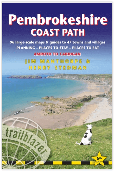
Wandelgids Pembrokeshire Coast Path - Trailblazer Publ.
299 km Rond de prachtige kustlijn van het Pembrokeshire Coast

Korte omschrijving
Pembrokeshire Coast Path - Trailblazer Productomschrijving: Amroth tot Cardigan - Het Pembrokeshire Coast Path, volgt een Nationaal Pad over 186 mijl (299 km) rond de prachtige kustlijn van ...

Specificaties
- Uitgever: Trailblazer Publications
- ISBN-13: 9781912716135
- HOOFDCATEGORIEËN: Wandelgids
- Activiteiten: Wandelen, Hiking & Trekking
- Auteur: Henry Stedman, Jim Manthorpe
- Regio: Pembrokeshire, Wales, South-West Wales
- Land: Wales
- Lange afstand wandelroutes: Pembrokeshire Coast Path National Trail (299 km)
- Nationale parken: Pembrokeshire Coast NP, Wales
- Blz.: 236
- Afmeting: 12x18
- Editie: 6
- Taal: Engels
Volledige omschrijving
Pembrokeshire Coast Path - Trailblazer
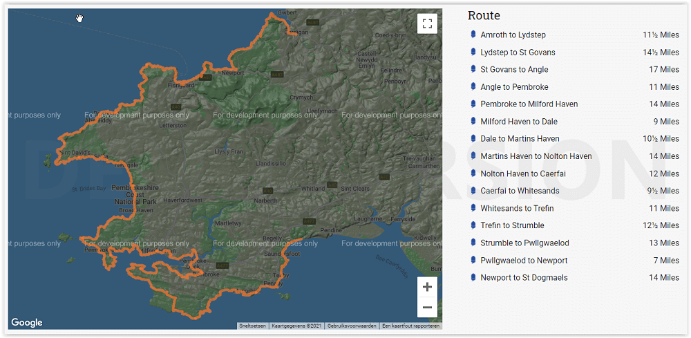
Productomschrijving: Amroth tot Cardigan - Het Pembrokeshire Coast Path, volgt een Nationaal Pad over 186 mijl (299 km) rond de prachtige kustlijn van het Pembrokeshire Coast National Park in het zuidwesten van Wales. Bekend om zijn ongerepte zandstranden, afgelegen baaien, kleine vissersdorpjes en eilanden rijk aan vogels en zeeleven, biedt dit nationale pad enkele van de beste kustwandelingen in Groot-Brittannië.Planning - Plaatsen om te overnachten - Plaatsen om te eten
Engelse omschrijving: The Pembrokeshire Coast Path follows a National Trail for 186 miles (299km) around the magnificent coastline of the Pembrokeshire Coast National Park in south-west Wales. Renowned for its unspoilt sandy beaches, secluded coves, tiny fishing villages and off-shore islands rich in bird and marine life, this National Trail provides some of the best coastal walking in Britain.Planning – Places to stay – Places to eat
236 pages
96 trail maps & 15 town plans
60 colour photos; 4pp colour flower guide
14 stage maps and 2 overview maps
Features:
1. Unique mapping features – In many walking guides the reader has to read a route description then try to relate it to the map. Our guides are easier to use because walking directions, tricky junctions, places to stay and eat, points of interest and walking times are all written onto the maps themselves in the places to which they apply. With their uncluttered clarity, these are not general-purpose maps but fullyedited maps drawn by walkers for walkers. Downloadable GPS waypoints also included.
2. The largest scale walking maps available – At just under 1:20,000 (8cm or 31/8 inches to 1 mile) our maps are bigger than even the most detailed walking maps currently available in the shops.
3. An all-in-one guide – Trailblazer guides include practical information not usually found in walking guides to the UK: reviews of places to stay, places to eat, attractions along the way and detailed public transport information showing all access points on the path, for weekend and day walkers.
Artikelen uit dezelfde regio

Wandelgids Pembrokeshire Coast Path - Cicerone • 9781786312082
Pembrokeshire Coast Path - Cicerone Productomschrijving: Deze nieuwe gids omvat de Pembrokeshire Coast Path National Trail, een 291 km lange kust wandelroute langs het befaamde Pembrokeshire Coastline in Wales. Omvat: St-Dogmaels, Goodwick, St-David's, Milford Haven, Amroth. Engelse omschrijving: This guidebook describes the Pembrokeshire Coast Path National Trail. The scenic 180 …

Wandelkaart XT40 Wales Coast Path 3 - Cardigan to LIanelli • 9781851376629
Wandelkaart Wales Coast Path 3 - Cardigan to LIanelli Productomschrijving: Het officiële pad is 300 kilometer, oftewel 186 mijl, en loopt van Amroth naar St. Dogmaels. Het Pembrokeshire Coast Path is een onderdeel van het Wales Coast Path, dat 1400 kilometer, oftewel 870 mijl, lang is en de gehele kust van Wales passeert. Het Pembrokeshire Coast Path passeert 58 stranden en 14 havens. …

Wandelgids Walking in Pembrokeshire - Cicerone Press • 9781852849153
Walking in Pembrokeshire - Cicerone Productomschrijving: Gids met 40 cirkelvormigewandelingen in Pembrokeshire in Wales. De routes gaan langs de dramatische schoonheid van het nationale park en de kust, de Daugleddau en de Preseli Hills, terwijl u beboste kloven, prehistorische heuvelforten en middeleeuwse kastelen verkent. De wandelingen variëren van 1 tot 12 mijl en de routebeschrijvinge…

Wandelkaart OL35 North Pembrokeshire Wales - OSI • 9780319475744
Wandelkaart North Pembrokeshire Wales - OSI Productomschrijving: Kaart nummer OL35 in de OS Explorer serie bestrijkt de kust van North Pembrokeshire en het Pembrokeshire Coast National Park aan de westkust van Wales. Hoogtepunten van het gebied zijn: St Davids, Cardigan, Goodwick en Fishguard, samen met het Pembrokeshire Coast Path. National Trails and recreation paths: * Ceredigi…

Wandelgids Pembrokeshire Tenby & the south - Cicerone • 9781786311757
Pembrokeshire Tenby & the south - Cicerone Productomschrijving: 15 van de beste korte wandelingen in Tenby en South Pembrokeshire. Onze gids is voorzien van goed leesbare Ordnance Survey-kaarten en duidelijke routebeschrijvingen, perfect als je voor het eerst gaat wandelen of op zoek bent naar iets waar je met het hele gezin van kunt genieten. Engelse omschrijving: 15 of the best short…