
Wandelgids Great Mountain Days in the Pennines - Cicerone
Gesorteerde routes die de Walliser fells en veenland dekken
Korte omschrijving
Wandelgids - Great Mountain Days in the Pennines - Cicerone Productomschrijving: Een inspirerende gids naar 50 klassieke wandelingen op het glooiende landschap van de Walliser. De gesorteerd...

Specificaties
- Uitgever: CICERONE Press
- ISBN-13: 9781852846503
- HOOFDCATEGORIEËN: Wandelgids
- Activiteiten: Wandelen, Hiking & Trekking
- Auteur: Terry Marsch
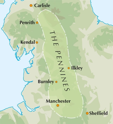
- Regio: Cumbria, England, North & North East England, North Yorkshire, Engeland
- Land: England
- Blz.: 256
- Afmeting: 17x24
- Taal: Engels
Volledige omschrijving
Wandelgids - Great Mountain Days in the Pennines - Cicerone
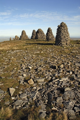
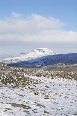
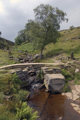
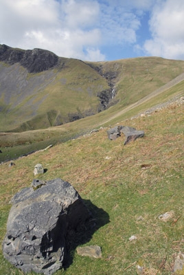
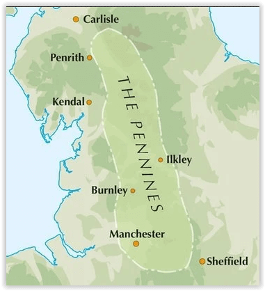
Productomschrijving: Een inspirerende gids naar 50 klassieke wandelingen op het glooiende landschap van de Walliser. De gesorteerde routes, tussen 6 en 13 mijl in lengte, dekken de klassieke Walliser fells en veenland zoals Whernside, Ilkley Moor en Pendle Hill; verkennen van Noord- en Zuid-Pennines, Yorkshire Dales, Howgills en Dark Peak. Veel routes zijn ook geschikt voor lopers. Een inspirerende gids naar 50 gedenkwaardige expedities in de Pennines, de iconische ruggengraat van Engeland. De exacte oppervlakte van de Pennines is moeilijk te definiëren.
Detail: In termen van dit boek breiden ze niet verder uit naar het zuiden van "Mam Tor" boven Edale, en niet veel verder noordelijk dan Cross Fell, de hoogste top van de Pennines, liggend op de oostelijke rand van Cumbria. Binnen dit gebied is een verbazingwekkende, en vaak frustrerende, opeenvolging van landschappen gevormd van riviervalleien, moorlands en hooggelegen Venen.
Product description: An inspirational guidebook to 50 classic walks on the rolling Pennine landscape. The graded routes, between 6 and 13 miles in length, cover classic Pennine fells and moorland such as Whernside, Ilkley Moor and Pendle Hill; exploring the North and South Pennines, Yorkshire Dales, Howgills and Dark Peak. Many routes are also suited to fell running.
Seasons:
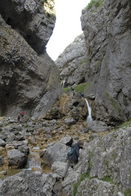
The Pennines can be tackled whatever the time of year, although the highest summits and the remote moors can be problematic in winter conditions or poor visibility.
Centres:
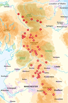
Walks are grouped into five areas: the North Pennines, the Howgills, the Yorkshire Dales, the South Pennines and the Dark Peak.
Difficulty:
Walks are graded from 'Moderate' to 'Strenuous' but unlike other mountainous areas where the ability to cope on rock and steep slopes is required, among the Pennines there also needs to be awareness of the deceptive nature of the landscapes, which, in spite of relative proximity to towns and cities, often feel remarkably remote; a sure grasp on navigational skills and self-protection is essential at all times.
Must See:
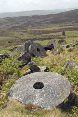
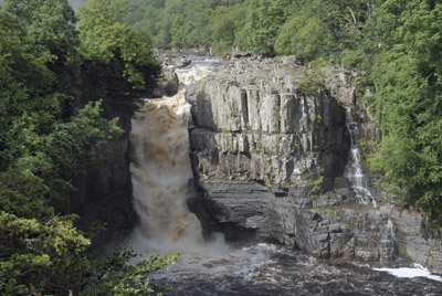
From the highest summits of the Pennines, to the seductive valleys of the Yorkshire Dales and the rugged landscapes of the South Pennines, this guide embraces all that is inspiring about the rolling Pennine landscapes.
Locatie op kaart
Artikelen uit dezelfde regio

Wandelgids The Pennine Way - Cicerone • 9781852849061
Wandelgids - The Pennine Way - Cicerone Productomschrijving: De Pennine Way National Trail met OS kaart boekje. De route van de 320 km van Edale naar Kirk Yetholm duurt drie weken om te lopen en is geschikt voor fit en langeafstand ervaren wandelaars. De route doorkruist het Peak District NP, de Yorkshire Dales NP en de North Pennines nationale parken. Bevat afzonderlijk boekje van de rout…

Wandelkaart 314 Solway Firth Wigton & Silloth - OSI • 9780319245668
Wandelkaart Solway Firth- Wigton & Silloth - Cumbria England Productbeschrijving: OS Explorer 314 toont de Solway Firth, Annan, Wigton en Silloth. Het omvat ook een deel van het nationale Scenic gebied van Nith estuarium, en de Solway Coast gebied van buitengewone natuurlijke schoonheid AONB. Er zijn eveneens de Cumbria Costal Way, Allerdale Ramble en deel van de Haridlan Wall Path. De OS …

Wandelgids Great Walks on the England Coast Path - Cicerone • 9781852849894
Great Walks on the England Coast Path - Cicerone Engelse omschrijving: At around 4500 km (2800 miles), the England Coast Path is the longest coastal trail in the world. This inspirational large-format guide presents a handpicked selection of 30 highlight sections, offering a taste of England's stunning and diverse shoreline. Routes range from 9 to 45km, spanning between 3 hours and 2 days,…

Wandelkaart 301 Scarborough- Bridlington - OSI • 9780319471739
Wandelkaart Scarborough- Bridlington & Flamborough Head Productbeschrijving: Kaart nummer 301 in de OS Explorer kaarten reeks heeft betrekking op de oostkust van Yorkshire rond Scarnorough, Bridlington en Flamborough Head. Hoogtepunten van het gebied zijn onder andere: Cleveland Way, de Yorkshire Wolds Way, Het nationall park zelf, en de North Sea Trail. De OS Explorer kaart voor Scarborou…

Wandelgids Hadrian's Wall Path short walks - Cicerone • 9781786311573
Hadrian's Wall Path - short walks - Cicerone Productomschrijving: Mark Richards heeft 15 van de beste korte wandelingen rond Hadrian's Wall voor je uitgezocht. Onze gids is voorzien van goed leesbare Ordnance Survey-kaarten en duidelijke routebeschrijvingen, perfect als je voor het eerst gaat wandelen of iets zoekt waar je met het hele gezin van kunt genieten. We hebben informati…