
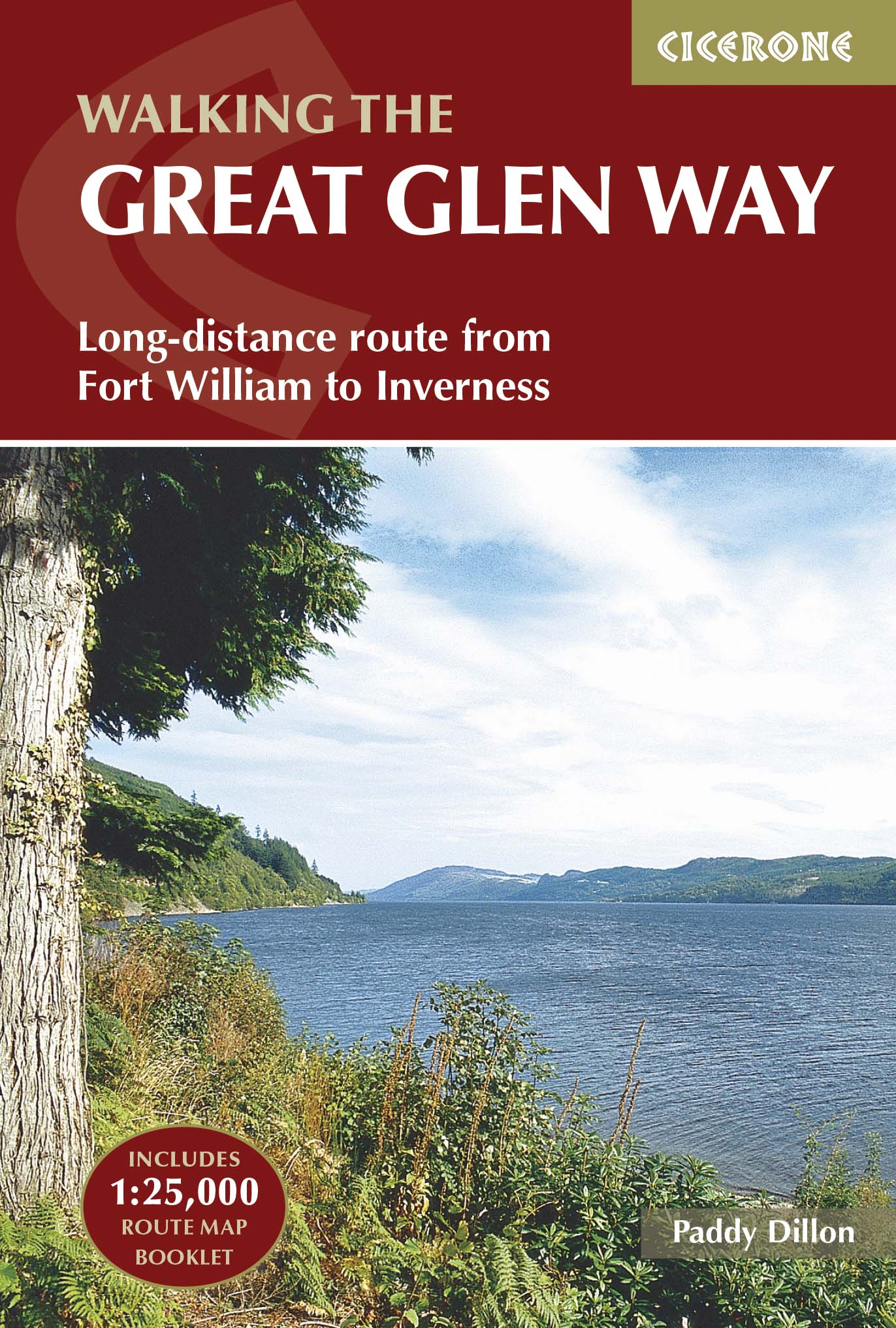
Wandelgids Great Glen Way- a two-way trail guide - Cicerone
langs het kanaal van Caledonia van Fort William naar Inverness
Korte omschrijving
Wandelgids - Great Glen Way- a two-way trail guide - Cicerone Productomschrijving: Wandelgids over de Great Glen way, een 90km lange National trail langs het kanaal van Caledonia van Fort Wi...

Specificaties
- Uitgever: CICERONE Press
- ISBN-13: 9781852848019
- HOOFDCATEGORIEËN: Wandelgids
- Activiteiten: Wandelen, Hiking & Trekking
- Regio: Highlands, Schotland
- Land: Schotland
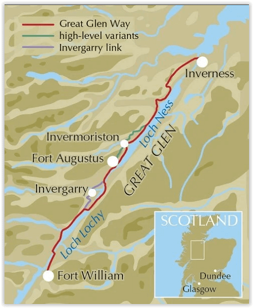
- Lange afstand wandelroutes: Great Glen Way, Schotland (127 km)
- Blz.: 192
- Afmeting: 12x17
- Editie: 2
- Taal: Engels
Volledige omschrijving
Wandelgids - Great Glen Way- a two-way trail guide - Cicerone
Productomschrijving: Wandelgids over de Great Glen way, een 90km lange National trail langs het kanaal van Caledonia van Fort William naar Inverness. Gemakkelijk af te lopen binnen een week in alle seizoenen, de route van de Great Glen way is een ideale introductie tot lange afstand wandelen in Schotland. De route is beschreven in beide richtingen.
Productdescription: Guidebook to walking the Great Glen Way, a 79 mile National Trail along the Caledonia Canal from Fort William to Inverness. Easily walked within a week in all seasons, the Great Glen Way is an ideal introduction to long-distance walking in Scotland. The route is described in both directions, and a separate OS 1:25K mapping booklet is included.
Product description: Guidebook to walking the Great Glen Way, a 79 mile National Trail along the Caledonia Canal from Fort William to Inverness. Easily walked within a week in all seasons, the Great Glen Way is an ideal introduction to long-distance walking in Scotland. The route is described in both directions, and a separate OS 1:25K mapping booklet is included.
Seasons:
Low-lying, so it is possible to walk the Great Glen Way at most times of year. Accommodation is often busy in summer, and midges are out! Daylight is short in winter and less accommodation is available.
Centres:
Inverness, Drumnadrochit, Invermoriston, Fort Augustus, North Laggan, Gairlochy, Fort William.
Difficulty:
The Great Glen Way is a 5-6 day low-level waymarked National Trail, with a range of facilities along the way. An ideal introduction to long-distance walking.
Must See:
Views of the highlands, fascinating clan history, Caledonian canal, wildlife (including, possibly, the Loch Ness monster).
Locatie op kaart
Artikelen uit dezelfde regio

Wandelkaart 409 Raasay Rona & Scalpay Schotland - OSI • 9780319472644
Wandelkaart Raasay- Rona & Scalpay - Highland's Schotland Productbeschrijving: Kaart nummer 409 in de OS Explorer kaart reeks is ideaal voor het verkennen van de Isle of Skye, Raasay, Rona en Scalpay. Hoogtepunten van het gebied zijn onder andere: Dun Caan, Brochel castle, clear Hebridean waters, & The Storr. De OS Explorer kaart voor Raasay, Rona & Scalpay is beschikbaar in zowel de stand…

Wandelkaart 449 Strath Halladale & Strathy Point - OSI • 9780319473016
Wandelkaart Strath Halladale & Strathy Point - Schotland Omvat ook: Melvich & Forsinard. Productbeschrijving: Aan de Noord kust van Schotland, volgt OS Explorer kaart 449 de Strath Halladale en de Halladale-rivier, en omvat Strathy Point, Melvich en Forsinard. Er zijn talrijke kleine lochs aanwezig, evenals de pieken van Beinn Ratha (242 m) en Channian Hil (302 m). De OS Explorer kaart…

Wandelkaart 435 An Teallach & Slioch- Schotland - OSI • 9780319246672
Wandelkaart An Teallach & Slioch - Schotland Productbeschrijving: 435 - An Teallach & Slioch , Schotland - OS Explorer kaart 435 omvat van Loch Broom down tot Kinlochewe, de nationale Scenic area van Wester Ross. Als u van plan bent om de Munros in te pakken, staan er op deze kaart 10, ondanks er weinig gemarkeerde paden zijn, zodat navigatie kennis essentieel is! De OS Explorer kaart …

Mountainbikegids West & Norh West Schotland - Cicerone • 9781852847463
Mountainbikegids - West & Norh West Schotland - Cicerone Productomschrijving: Deze gids beschrijft 25 mountainbike routes in Noord- en Noord West Schotland, een gebied met inbegrip van Fort William, Rannoch Moor, Glen Spean, Invergarry, Loch Sunart, Strathfarrar, Kinlochewe, Sutherland, de Buiten-Hebriden en de bergen van Torridon. De routes variëren van 19,5 km tot 73.25 km, blauw, rood o…

Wandelkaart 385 Rannoch Moor & Ben Alder- Schotland - OSI • 9780319472514
Wandelkaart Rannoch Moor & Ben Alder - Loch Rannoch Schotland Omvat ook: Loch Rannoch. Productbeschrijving: Kaart nummer 385 omvat Rannoch Moor en Ben Alder. Hoogtepunten zijn Loch Rannoch, Loch Laidon en het Cairngorms National Park & Tay Forest Park. Omvat ook Blackwater Reservoir, Loch Ossian en Loch Eigheach. De OS Explorer kaart voor Rannoch Moor & Ben Alder is beschikbaar in zowe…