
Wandelgids - GR10 Trail through the French Pyrenees - Cicerone
Le Sentier des Pyrénées- 955km lange tocht door de Pyreneeën
Korte omschrijving
Wandelgids - GR10 Trail through the French Pyrenees - Cicerone Productomschrijving: Wandelgids over de GR10, "Le Sentier des Pyrénées", een 955km lange tocht door de Franse Pyreneeën van He...

Stockactie
Specificaties
- Uitgever: CICERONE Press
- ISBN-13: 9781852847739
- HOOFDCATEGORIEËN: Wandelgids
- Activiteiten: Wandelen, Hiking & Trekking
- Regio: Occitanië, Frankrijk
- Land: Frankrijk
- Departement: Pyrénées-Orientales (66)
- Blz.: 320
- Afmeting: 12x17
- Editie: 1
- Taal: Engels
Volledige omschrijving
Wandelgids - GR10 Trail through the French Pyrenees - Cicerone
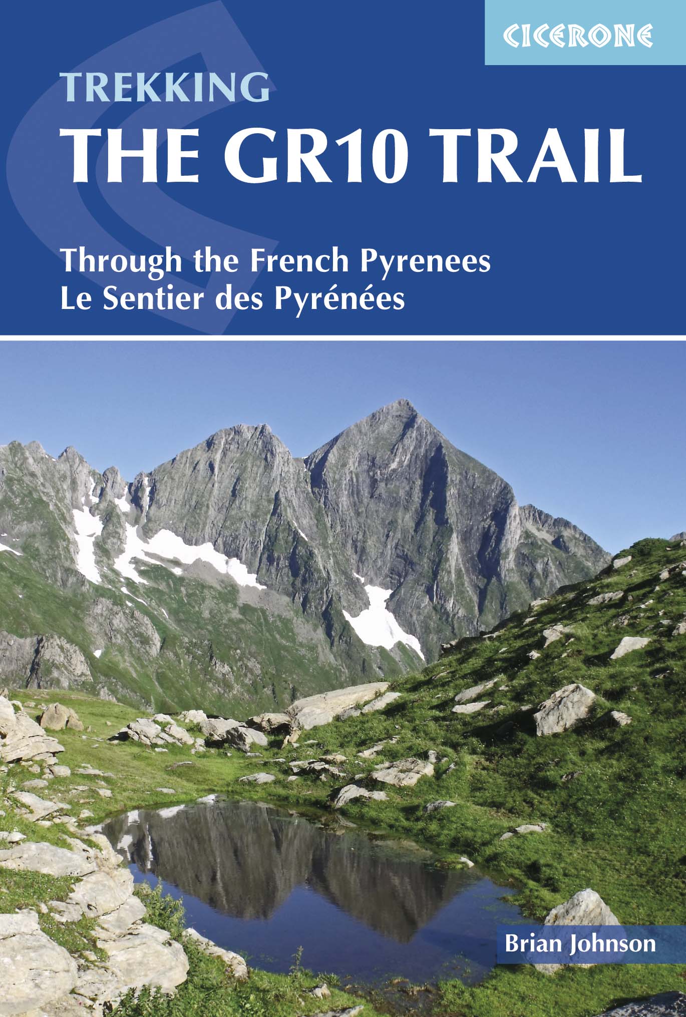
Productomschrijving: Wandelgids over de GR10, "Le Sentier des Pyrénées", een 955km lange tocht door de Franse Pyreneeën van Hendaye aan de Atlantische kust tot de Middellandse Zeekust in Banyuls-sur-Mer. Het boek beschrijft 55 etappes, met informatie over planning, vervoer, accommodatie en faciliteiten. U kunt de hele GR10 in ongeveer 45 dagen of in korter afleggen.
Productdescription: Guidebook to walking the GR10, the Sentier des Pyrénées, a 955km trek across the French Pyrenees from Hendaye on the Atlantic Coast to the Mediterranean coast at Banyuls-sur-Mer. The book describes 55 stages, with information on planning, transport, accommodation and facilities. Walk the entire GR10 in around 45 days or in shorter trips.
Product description: Guidebook to walking the GR10, the Sentier des Pyrénées, a 955km trek across the French Pyrenees from Hendaye on the Atlantic Coast to the Mediterranean coast at Banyuls-sur-Mer. The book describes 55 stages, with information on planning, transport, accommodation and facilities. Walk the entire GR10 in around 45 days or in shorter trips.
Seasons:
Best July to October (June in a low snow year).
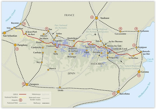
Centres:
Hendaye-Plage on the Atlantic coast to Banyuls-sur-Mer on the Mediterranean through the French Pyrenees.
Difficulty:
The GR10 is extremely well waymarked following good mountain paths with short sections of boulderfield and occasional very easy scrambling. It is tough because there is more steep climb and descent than on many long-distance paths. Good network of inexpensive accommodation for those who prefer not to camp. Frequent resupply possible. In early season (May/June) ice-axe and crampons may be required.
Must See:
The GR10 starts with the rolling hills of the Basque country leading to the High Pyrenees including Pic du Midi d'Ossau, Vignemale and Gavarnie. The remote Ariège with Mont Vallier follows and Canigou dominates the approach to the Mediterranean. Wildflower meadows are magnificent throughout.
Locatie op kaart
Artikelen uit dezelfde regio

Wandelkaart GR10 - la traversée des Pyrénées - IGN • 9782758551294
GR10 - la traversée des Pyrénées - IGN Productomschrijving: Traversée des Pyrénées (GR®10) Een middelzwaar bergpad, meer dan 900 km lang en 55.000 meter D+ en evenveel D-. De kilometers plat zijn op de vingers van één hand te tellen! Dat maakt het een route voor doorgewinterde wandelaars. Het is een prachtig avontuur, tussen zee, bergen, valleien en passen. Knippen van de originele en…

Wandelkaart 2539 SB Sévérac-le-Château & Lapanouse - IGN • 9782758544852
Wandelkaart - Sévérac-le-Château & Lapanouse Productomschrijving: Sévérac-le-Château & Lapanouse zijn beiden gemeente in het Franse departement Aveyron in de regio Occitanie en liggen beiden aansluitend aan het nationale parc van de Cevennen. De plaats maakt deel uit van het arrondissement Millau. Sévérac-le-Château ligt in het Centraal Massief. De locaties dienen als perfecte uitvalsbasis…

Wandelkaart 2043 ET Toulouse & Forêt de Bouconne - IGN • 9782758546399
Wandelkaart Toulouse & Forêt de Bouconne - IGN Productomschrijving: Toulouse is gelegen aan de rivier Garonne, en is tevens hoofdstad van de regio van Midi Pyrénées, nu Occitanië genaamd. Ombvat: Toulouse, Castelginest, Launaguet, Colomiers, Cornebarrieu, Merville, Ramonville-Saint-Agne, Cugnaux, Pibrac, Lespinasse, Gratentour, Saint-Geniès-Bellevue, L'Union, Saint-Loup-Cammas, Saint-A…

Wandelgids Les Sentiers d'Emilie dans le Tarn - Rando • 9782841824175
Les Sentiers d'Emilie dans le Tarn - 25 Balades pour tous Productomschrijving: Deze wandelgids, biedt u een mooi overzicht over de wandelroutes in één van Frankrijks mooiste gebieden, "le Tarn", en dat in de reeks van "Les Sentier d'Emilie", een reeks die u nooit onbewogen laat, welke gids u ook kiest. Deze gids biedt u 25 prachtige uitgezochte routes, samengesteld door mensen die de route…

Wandelkaart 2940 OT Bagnols-sur-Cèze & Pont-St-Esprit - IGN • 9782758546610
TOPO Wandelkaart - Bagnols-sur-Cèze & Pont-St-Esprit- Occitanië Productomschrijving: Agnols-sur-Cèze & Pont-St-Esprit zijn gemeentes in het Franse departement Gard in de regio Occitanie. Ze worden vergezeld door het regionale park van Forêts de Valbonne, die zo'n beetje de hoofd reden is waarom mensen deze locatie kiezen als vakantie of wandelbestemming. Productomschijving: De TOP 25 …