
Wandelgids Glyndwr's Way walking - Cicerone
Van Knighton via Machynlleth naar Welshpool - 217 km

Korte omschrijving
Glyndwr's Way walking - Cicerone Productomschrijving: Gids over de hystorische wandelroute van de Glyndwr's Way, een langeafstandspad door midden-Wales. De 217 Km lange route van Knighton vi...

Specificaties
- Uitgever: CICERONE Press
- ISBN-13: 9781786311290
- HOOFDCATEGORIEËN: Wandelgids
- Activiteiten: Wandelen, Hiking & Trekking
- Regio: Wales
- Historische wandelroutes: Glyndwr's Way, Wales (217 km)
- Lange afstand wandelroutes: Glyndwr's Way, Wales (217 km)
- Blz.: 176
- Afmeting: 12x17
- Editie: 3
- Taal: Engels
- Reeks: National Trails, UK
Volledige omschrijving
Glyndwr's Way walking - Cicerone
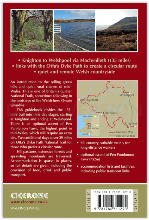
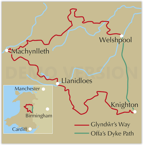
Productomschrijving: Gids over de hystorische wandelroute van de Glyndwr's Way, een langeafstandspad door midden-Wales. De 217 Km lange route van Knighton via Machynlleth naar Welshpool duurt 9 dagen om te lopen, en 2 dagen (29 mijl) om de lus langs het Offa's Dyke Path af te maken zodat er een rondwandeling ontstaat. Een prachtige route door rustige heuvels, bossen en glooiend landschap.
Engelse omschrijving: Guidebook to walking Glyndwr's Way, a long-distance National Trail through mid-Wales. The 135 mile route from Knighton via Machynlleth to Welshpool takes 9 days to walk, and 2 days (29 miles) to complete the loop down the Offa's Dyke Path to create a circular trail. A lovely trail through quiet hills, forests and rolling countryside.
Seasons:
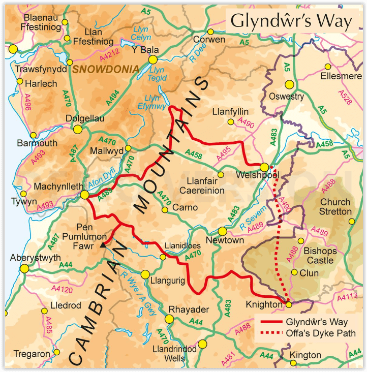
Spring, summer and autumn are ideal for walking; winter can be a problem if there is deep snow; after prolonged rain some parts can be muddy
Centres:
Knighton, Llangunllo, Felindre, Llanbadarn Fynydd, Abbeycwmhir, Llanidloes, Dylife, Machynlleth, Cemmaes Road, Llanbrynmair, Llangadfan, Llanwddyn, Dolganog, Meifod, Welshpool, Montgomery.
Difficulty:
Suitable mainly for long-distance walkers; essentially hill country, with lots of ascents and descents, but also many gentle and easy stretches; careful attention to waymarking is required and accommodation is sparse in some places.
Must See:
Quiet and remote mid-Wales countryside, links with the Offa's Dyke Path, Abbeycwmhir ruins, Llyn Clywedog, Dylife mines, Parliament House at Machynlleth, Dyfnant Forest, Llyn Efyrnwy, Ann Griffiths Walk, Powis Castle.
Artikelen uit dezelfde regio

Reisgids Great Britain - DK Eyewitness • 9780241408292
Reisgids Great Britain - DK Eyewitness Productomschrijving: Visit Stonehenge's mysterious monoliths, take the sea air in buzzing Brighton or come face to face with the Vikings in York: everything you need to know is clearly laid out within colour-coded chapters. Discover the best of Great Britain with this indispensable travel guide. Inside DK Eyewitness Travel Guide Great Britain: -…

Klimgids Ridges of England- Wales & Ireland - Cicerone • 9781852845391
Klimgids - Ridges of England- Wales & Ireland - Cicerone Productomschrijving: Een gids voor zomerscrambles, technische rockroutes en winterbeklimmingen op ruggen in het Lake District, Snowdonia, Peak District, Exmoor, het eiland Wight, Kerry en Connemara, die betrekking hebben op populaire klassiekers en duistere edelstenen, van scherpe rand naar skelet Ridges. Deze handleiding is met grot…


Wandelgids Wales - 50 wandelingen met GPS - Elmar • 9789038926933
Wandelgids Wales - 50 wandelingen Productomschrijving: Wales, een soort stukje Engeland, maar dan weer niet. Eenn stukje met zijn eigen cultuur, zijn eigen wandelcultuur en zijn eigen nationale parken. Deze Rother wandelgids Wales beschrijft de 50 mooiste kust- en bergwandelingen in het westen van het Verenigd Koninkrijk - van Pembrokeshire tot Anglesey, van de Ierse Zee tot de grens met E…

Wandelkaart 114 Anglesey & Ynys Môn N.W. Wales - OSI • 9780319262122
Wandelkaart Anglesey & Ynys Môn North West Wales - OSI Productbeschrijving: Kaart nummer 114 is een all purpose kaart vol gepakt met informatie om u het gebied te helpen leren kennen. De 204 Landranger-kaarten bestrijken het land. Elke kaart heeft een oppervlakte van 40 km door 40 km (25 mijl door 25 mijl) en zoals andere kaarten van Ordnance Survey, National Grid-vierkanten worden verstr…

Klimgids Welsh Winter Climbs - Cicerone • 9781852840013
Klimgids - Welsh Winter Climbs - Cicerone Productomschrijving: Klimgids, winter beklimmingen in Wales. Alle klassieke winterroutes, plus vele korte rotsbeklimmingen. Bedekt Carneddau, Glyderau, Llanberis, Yr Wyddfa, Nantlle, Lleyn Schiereiland, Moelwynion, Rhinog, Cader Idris, Aran, Dyfi en Berwyn. Het biedt een volledige beschrijving, over het al dan niet beschikbaar zijn van routes, en t…