
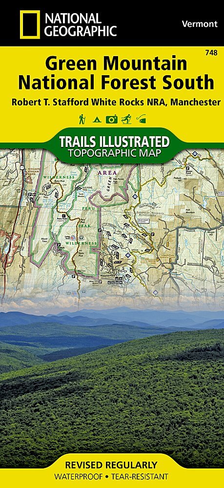
Wandelkaart 748 Green Mountain National Forest
Een régionaal park gelegen in Vermont
Korte omschrijving
TOPO Wandelkaart 748 - Green Mountain National Forest - Vermont USA, National Geographic Productomschrijving: De Zuidelijke zijde van Green Mountain National Forest, is een régionaal park ge...

Specificaties
- Uitgever: National Geographic
- ISBN-13: 9781566955126
- HOOFDCATEGORIEËN: Wandelkaart
- Land: Verenigde Staten van Amerika (USA)
- Regionale parken: Green Mountain National forest, Vermont USA
- Schaal: 1:70000
- Afmeting: 10x19
- Taal: Engels
Volledige omschrijving
TOPO Wandelkaart 748 - Green Mountain National Forest - Vermont USA, National Geographic
Productomschrijving: De Zuidelijke zijde van Green Mountain National Forest, is een régionaal park gelegen in Vermont. Dit park ondersteunt een grote variatie van wildlife, incl. beaver, moose, coyote, black bear, white-tailed deer, wild turkey, en ruffed grouse. Het park, die gelegen is in Vermont's Green Mountains, word aanschouwd als de 'Granite backbone of the state'.
Engelse omschrijving: National Geographic's Trails Illustrated map of Green Mountain National Forest South is the perfect travel companion for outdoor enthusiasts seeking to enjoy the four season recreation experience of the area. Expertly researched and created in cooperation with the U.S. Forest Service and others, the map delivers unparalleled detail of the forest from the city of Rutland to its southern boundary and includes such popular points of interest as Robert T. Stafford White Rocks National Recreation Area; Coolidge State Forest; Big Branch, Lye Brook, Glastenbury, George D. Aiken and Peru Peak Wilderness Areas; Killington, Mount Snow and Stratton Mountain Ski Areas; Harriman and Somerset Reservoirs; and Jamaica and Lake Shaftsbury State Parks.
Follow clearly mapped trails, marked for hiking, biking or horseback riding use, as you explore the area. The Appalachian and Long Trails, which merge, are highlighted as is the Catamount Trail. Non-motorized winter use trails are marked as well. To aid in your navigation, the map shows contour lines, elevations, labeled peaks, water features, areas of wooded cover, selected waypoints and color-coded land management boundaries. Recreation features for all season are labeled, including campgrounds, shelters, swimming and fishing areas, downhill and cross-country ski areas, ski jumps and scenic viewpoints. The map also provides background information of the forest and the wilderness areas, regulations, safety tips and contact information. Every Trails Illustrated map is printed on "Backcountry Tough" waterproof, tear-resistant paper. A full UTM grid is printed on the map to aid with GPS navigation.Other features found on this map include: Bennington, Big Branch Wilderness, Dorset Mountain, Glastenbury Wilderness, Glebe Mountain, Green Mountain National Forest, Harriman Reservoir, Hoosac Range, Killington Peak, Lye Brook Wilderness, Markham Mountain, Mount Anthony, Mount Snow, Peru Peak Wilderness, Rutland, St.png)
Locatie op kaart
Overzichtskaarten

NAT GEO New York trail map
NAT GEO New York trail map

Producten op de overzichtskaart
Klik op een product om naar de detailpagina te gaan.
- Wandelkaart 738 Allegheny National Forest North - Nat Geo
- Wandelkaart 742 Adirondack Park - Lake Placid - Natgeo
- Wandelkaart 745 Adirondack Park - Old Forge & Oswegatchie
- Wandelkaart 746 Adirondack Park - Saranac & Paul Smiths
- Wandelkaart 747 Green Mountain National Forest- Vermont
- Wandelkaart 743 Adirondack Park - Lake George - Natgeo
- Wandelkaart 744 Adirondack Park - Northville & Raquette Lake
- Wandelkaart 748 Green Mountain National Forest
- Wandelkaart 756 Harriman- Bear Mountain & Sterling Forest parks