
Wandelkaart 234 Mammoth Cave NP- Kentucky - Nat Geo
Met het grootste door de mens gemaakte cave systeem ter wereld
Korte omschrijving
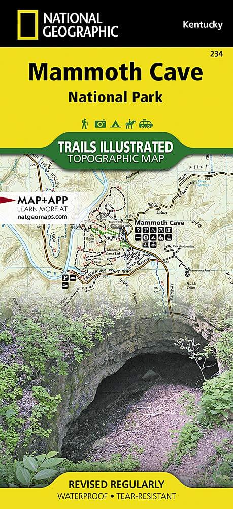
TOPO Wandelkaart 234 - Mammoth Cave NP- Kentucky - Nat Geo Productomschrijving: Mammoth Cave National Park is een Amerikaans nationaal park in centraal Kentucky. Mammoth Cave beschikt over h...

Specificaties
- Uitgever: National Geographic
- ISBN-13: 9781566952361
- HOOFDCATEGORIEËN: Wandelkaart
- Activiteiten: Wandelen, Hiking & Trekking
- Regio: Kentucky, USA
- Land: Verenigde Staten van Amerika (USA)
- Nationale parken: Mammoth Cave NP, Kentucky USA
- Schaal: 1:35000
- Afmeting: 10x19
- Taal: Engels
Volledige omschrijving
TOPO Wandelkaart 234 - Mammoth Cave NP- Kentucky - Nat Geo
Productomschrijving: Mammoth Cave National Park is een Amerikaans nationaal park in centraal Kentucky. Mammoth Cave beschikt over het grootste door de mens gemaakte cave systeem ter wereld.
Engelse omschrijving: The world's longest known cave system, Mammoth Cave is a fascinating and beautiful labyrinth located below the equally scenic Green River valley and hilly country of south central Kentucky. National Geographic's Trails Illustrated map of Mammoth Cave National Park delivers unmatched detail and valuable information to assist you in your exploration of this unique and compelling region. Expertly researched and created in partnership with local land management agencies, this map features key points of interest including Green and Nolin rivers; First Creek Lake; Houchin Ferry; Turnhole Bend; Dennison Ferry; Maple Springs; and the cities of Brownsville and Park City. The print version of this map includes a detailed inset of the cave area, along with general information about the park and cave, as well as an inset of the historic entrance and vicinity.
Designed with a wide range of visitors in mind, this map features detailed topography with contour lines, shaded relief and elevations; easy-to-read trails that are clearly marked according to use; accurate road network; visitor centers and facilities; plus, park regulations, and contact information for local agencies. Trail mileage between intersections will help you choose the path that's right for you. Boaters will appreciate the notation of river mileage, launch sites, and access points. Recreation features are clearly marked, including trailheads, campgrounds, fishing areas, interpretive trails, picnic areas, and rental cabins. Every Trails Illustrated map is printed on "Backcountry Tough" waterproof, tear-resistant paper. A full UTM grid is printed on the map to aid with GPS navigation.
Other features found on this map include: Mammoth Cave National Park, Nolin River, The Knobs.
Locatie op kaart
Artikelen uit dezelfde regio

Wandelkaart 241 Big South Fork National Recreation Area - Nat Geo • 9781566953542
Big South Fork National Recreation Area - Nat Geo Productomschrijving: National Geographic's Trails Illustrated kaart van Big South Fork National River and Recreation Area is een perfecte kaart voor alle recreatieve activiteiten in dit prachtige gebied, of het nu gaat om wandelen, fietsen, verkennen, raften, klimmen, kamperen of paardrijden. Deze deskundig onderzochte kaart werd gemaakt in…

Wandelkaart 793 Clinch Ranger District USA - Nat Geo • 9781566951500
Clinch Ranger District USA - Nat Geo Productomschrijving: National Geographic's Trails Illustrated kaart van Clinch Ranger District bestrijkt het zuidelijkste deel van Jefferson National Forest dat de grens tussen Virginia en Kentucky en aangrenzende recreatiegebieden doorkruist. Gemaakt in samenwerking met de U.S. Forest Service en anderen, deze deskundig onderzochte kaart is een uitgebre…