
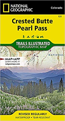
Wandelkaart 131 Crested Butte- Pearl Pass - Nat geo
Een rustige wandel- en MTB uitvalsbasis in Gunnison County
Korte omschrijving
TOPO Wandelkaart 131 - Crested Butte- Pearl Pass Colorado, USA - National geographic Productomschrijving: Crested Butte is een rustige wandel- en MTB uitvalsbasis in Gunnison County, Colorad...

Specificaties
- Uitgever: National Geographic
- ISBN-13: 9781566952477
- HOOFDCATEGORIEËN: Wandelkaart
- Regio: Colorado, USA
- Land: Verenigde Staten van Amerika (USA)
- Schaal: 1:40000
- Afmeting: 10x19
- Taal: Engels
Volledige omschrijving
TOPO Wandelkaart 131 - Crested Butte- Pearl Pass Colorado, USA - National geographic
Productomschrijving: Crested Butte is een rustige wandel- en MTB uitvalsbasis in Gunnison County, Colorado, United States. Omvat de oude kool industrie, en noemt nu "the last great Colorado ski town". Crested Butte is aeveneens een locatie voor skiërs & mountainbiking, als ook een verzameling van andere outdoor activiteiten. De 'Colorado General Assembly' noemt deze regio 'Crested Butte the Wildflower Capital of Colorado'.
Engelse omschrijving: National Geographic's Trails Illustrated map of Crested Butte and Pearl Pass offers unparalleled detail for outdoor enthusiasts seeking to enjoy the year-round recreational opportunities available in this mountainous area on the west side of the Continental Divide. Created in partnership with the U.S. Forest Service, Bureau of Land Management and others, this expertly researched map covers key areas of interest including Gunnison National Forest, Maroon Bells-Snowmass and Collegiate Peaks Wilderness areas, Crested Butte Ski Area, Elk Mountains, Taylor River, Taylor Park Reservoir, West Elk Loop Scenic Byway and the Continental Divide.
Trailheads will lead you to precisely mapped trails with clear mileage indicators, labeled according to their designated usage, whether your adventure involves hiking, cross-country skiing, biking, snowmobiling or using some other motorized vehicle. The map features shaded relief; contour lines with elevations; labeled passes, peaks and summits; and reservoirs, rivers and other water features. Some of the many recreation features include campgrounds, boat launch and river access points, and fishing areas. Every Trails Illustrated map is printed on "Backcountry Tough" waterproof, tear-resistant paper. A full UTM grid is printed on the map to aid with GPS navigation.
Other features found on this map include: Collegiate Peaks Wilderness, Gunnison National Forest, Maroon Bells-Snowmass Wilderness, Taylor Park Reservoir.
Locatie op kaart
Artikelen uit dezelfde regio

Wandelkaart 141 Telluride- Silverton- Ouray & Lake City - Nat Geo • 9781566953405
Wandelkaart Telluride- Silverton- Ouray & Lake City - Nat Geo Productomschrijving: De National Geographic Trails Illustrated kaart van Telluride, Silverton, Ouray, en Lake City is deskundig onderzocht en gemaakt in samenwerking met lokale landbeheerders. Het is een ongeëvenaard hulpmiddel voor het verkennen van deze adembenemende regio van Colorado. Ongeacht het seizoen is deze kaart een h…

Wandelkaart 140 Weminuche Wilderness Colorado USA - Nat Geo • 9781566952910
Wandelkaart Weminuche Wilderness Colorado USA - Nat Geo Productomschrijving: De Weminuche Wilderness overspant de Continental Divide en is met bijna een half miljoen hectare het grootste wildernisgebied in Colorado. Deskundig onderzocht en gemaakt in samenwerking met lokale landbeheerders, biedt National Geographic's Trails Illustrated kaart van de Weminuche Wilderness een ongeëvenaard hul…

Wandelkaart 1304 Colorado Backpack Loops- Noord - Natgeo • 9781566957557
TOPO Wandelkaart 1304 - Colorado Backpack Loops- Noord - Natgeo Productomschrijving: Colorado is gelend voor zijn outdoor recreatrieve opportuniteiten. Eén van deze bezigheden is uiteraard backcountry & hiking. De Colorado Backpack Loops North Topographic Map Guide omavt de dozijn aan cirkelvormige wandelroutes geselecteerd door het personeel van National Geographic voor hun diversiteit, h…

Wandelkaart 127 Aspen - Independence Pass - Colorado USA • 9781566953580
TOPO Wandelkaart 127 - Aspen - Independence Pass - Colorado USA Productomschrijving: Independence Pass in Aspen Colorado is een uitmuntende wandellocatie. Deze omvat een topografische wandelkaart die echt tot de verbeelding spreekt. Een subliem exemplaar als het over wandelen gaat. Engelse omschrijving: Independence Pass, originally known as Hunter Pass, is a high mountain pass in cen…

Wandelkaart 110 Leadville & Fairplay - Colorado - Nat Geo • 9781566953641
TOPO Wandelkaart 110 - Leadville & Fairplay - Colorado - National Geographic Productomschrijving: Leadville & Fairplay zijn locaties in de Amerikaanse staat Colorado. De dorpen liggen op een hoogte van 3000 meter, en zijn daarmee een van de hoogstgelegen steden van Colorado. In het begin van de tijd van de goudkoorts ontstond de nederzetting, in het jaar 1859. Het is een meestal rustige st…